Trillolara Links
- entrance page
- Boonmuck, Trillolara
- Potter
- old map, Dtranyo Castle area
- Arrival in Trillolara, heading to Fondfield
- progress and arrival
- in Fondfield
- Military Arms, Guards and City Defense part 1, Fondfield | Military Arms, Guards and City Defense part 2 | Military Arms, Guards and City Defense part 3
Dtillan Orsti area information
Fondfield is down and to the right, southeast, of this area. Dwarf Home is up North. Hommlet is off to the South. The player characters journeyed by trail on to Dwarfbas. There they set up for their adventures in Dwarf Home.
This map was drawn using a 5 mile hexagon based on the Judges Guild Campaign Hexagon System maps.
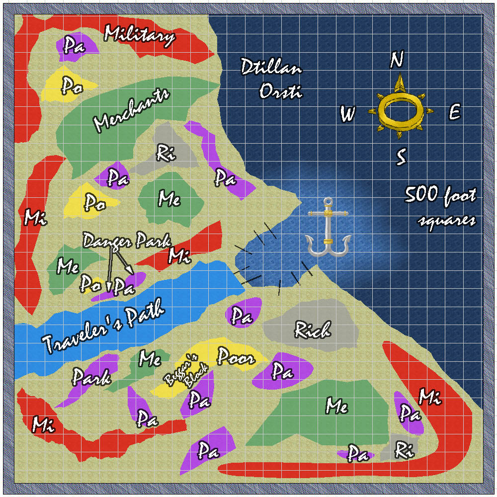
The squares are 500 feet by 500 feet.
Map showing the different areas within Dtillan Orsti. Map redone Feb 20, 2015.
Pa = Park
Po = Poor
Ri = Rich
Mi = Military
Travelers’ Path is the safest way from travelers and adventurers to go from the seaport to the interior and vice-versa. Safest way ? Yes, Dtillan Orsti is old, much older than many towns, cities, and nations. A rather dangerous place if a character gets involved in local politics. Sallor and Fondfield are days travel away. Their influence is much diminished here.
The areas not marked are too small to show on this map.
When I get them updated to CC3, I’ll post the geomoprhs that go with the different parts of this city.
